SHPTRANS is a fast, high-precision NTv2 datum transformation and projection utility which reads and writes shapefiles. SHPTRANS is intended to complement, not replace, existing projection tools such as those within ArcView GIS 3.x and ArcGIS 8.x.SHPTRANS supports the following projections: UTM (tested for North America; intended to support all 60 zones in both hemispheres), MTM 3-degree (tested for Atlantic Canada; intended to also support Quebec), arbitrary TM (any TM projection with 0 as the latitude of origin); as well as the Double Stereographic projections used in New Brunswick and Prince Edward Island. The input and output coordinate system can be any of these projections, or lat/long decimal degrees. If a projection is specified, the map units are taken as metric by default. (However, with the latest development versions, you can specify other units such as kilometres, feet, or miles.)
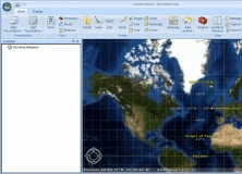
It adds projections and geotransformations for use with ArcGIS Explorer Desktop.

A Computer Code for Simulation of Two-Phase Ground-Water Flow and Heat Transport


Comments